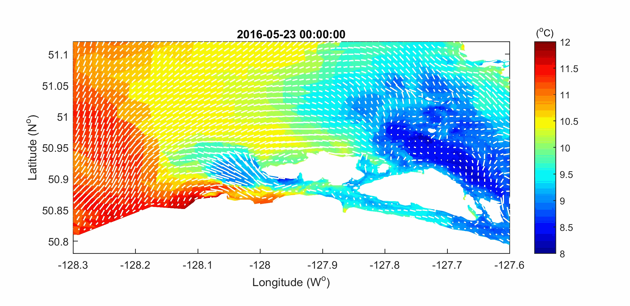
ASL has developed processes and systems to manage metocean projects. These include processes and systems for document management, data management, quality management, and health, safety and environment (HSE) systems. We are very proud of our success in collecting metocean data in some of the world’s most challenging oceanographic environments. ASL has developed its own hydrodynamic model and runs publicly available models such as 3-D unstructured Finite Volume Community Ocean Model (FVCOM), Delft3D, and SWAN. ASL has a complete MATLAB- based suite of software for the editing, analyses and visualization of metocean data.
Besides wave modeling for metocean studies, ASL has implemented the SWAN wave model in a number of other coastal projects, including modeling nearshore spectral wave transformation off the west coast of Vancouver Island (Jiang and Fissel, 2003), modeling nearshore spectral wave transformation off the west coast of Africa (Fissel and Jiang, 2004), modeling locally wind-generated waves in the Strait of Georgia and Roberts Bank (Jiang and Fissel, 2005), modeling ocean waves at Victoria's Fisherman’s Wharf (Fissel, et al., 2007), and wave modeling for Victoria International Marina with and without attenuators (Jiang and Fissel, 2008 and 2009; Fissel and Lin 2012; Lin and Fissel 2014). (read full background)
Median values of bottom shear stresses (BSS) in Nass Bay and Iceberg Bay based on model results from August 1 to November 30, 2017.
Numerical modeling is a powerful method of visualizing the dynamic behaviour of physical systems. Our three-dimensional computer models are capable of accurately simulating water circulation in the following environments:
Correlation coefficients between time series of BSS and absolute values of water level anomalies
Successful calibration and validation of a numerical model against field measurements is an affirmation of our understanding of the natural environment being studied. The power of our computer models lies in its ability to predict currents, temperature, salinity and sediment in regions where data is sparse or when extensive data collection is expensive or impractical. Our models can undertake "what if" studies to investigate the impact on river, estuarine or coastal circulation patterns of the placement, for instance:
Victoria Harbour Flood Inundation
For coastal planning, looking at sea level rise only based on climate change is insufficient. The tide, storm surge, and wave setup are required to obtain projections of episodic coastal flooding. ASL develops high resolution regional numerical models to evaluate the contributions and complex interactions from four important contributors: (1) regional relative sea level rise due to climate change, (2) storm surge, (3) extreme tides and (4) wave runup. These complex and ever-changing interactions can generate excessive sea level rise, particularly during storms. Using the coupled hydrodynamic and wave model, vulnerable “hot-spots” can be identified. In this demonstration, we quantitatively present the assumed flood inundation in Victoria’s Inner Harbour with the combined effects of extreme events and sea level rise.
Vector and Drifter Simulations near Prince Rupert
Sea Surface Temperature and Surface Currents
Victoria Harbour Flood Inundation